If you are developing in Iowa, it’s important to include wetland delineation early on in your site selection process to avoid costly design changes due to regulations by the Environmental Protection Agency (EPA) and U.S. Army Corps of Engineers (Corps).
Locations chosen for development in Iowa often contain low-lying areas with aquatic resources that could be impacted by development.
Section 404 of the Clean Water Act regulates the discharge of dredged or fill material into Waters of the United States (WOTUS), which currently includes wetlands, streams, and other aquatic resources. Civil penalties, fines, or other punishment could be levied by the EPA and Corps if you run afoul of this regulation.
Wetland delineation helps you identify the location of aquatic resources, look for ways to minimize or avoid impacts to them, and if needed, acquire permits before starting development.
While pursuing wetland delineation adds another step to development, it is a necessary step to help you comply with the laws protecting aquatic resources while avoiding delays or changes to your project and schedule.
Save Time and Money with Wetland Delineation
More appropriately called “Waters of the United States” delineation, this service can help anyone who plans a development learn if their site has protected aquatic resources present.
Work with a wetland professional to work through the following delineation process:
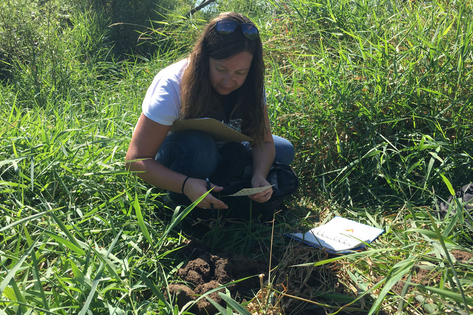
- Determine if any jurisdictional WOTUS are located on the site. Please note, an official wetland delineation should be conducted during the growing season (in Iowa, this is typically from May to October) because the consultant needs to determine:
- Is wetland hydrology present?
- Are wetland soils present?
- Is wetland vegetation present?
- If any of these indicators are absent, the site does not contain a wetland and no further action is needed.
- If it is determined that WOTUS may be present, a wetland delineation report will be developed. With preliminary plans for development in place, the consultant can help you identify changes to the layout and design that will minimize impacts while still fulfilling your goals (i.e. cost, design, scheduling) for the site.
- Determine what permitting is needed and submit applications to regulatory agencies on your behalf.
- The Corps and other applicable regulatory agencies will determine if permits can be issued and if mitigation will be required. If mitigation is necessary, credits can be purchased from an approved mitigation bank or built as part of permittee-responsible mitigation. If mitigation is anticipated, the consultant can help you plan for it in advance by researching which mitigation banking sites are within your service area or investigate if on-site mitigation makes more sense. Then you will be ready to act.
Scheduling should be taken into consideration during project planning. Delineations and agency review/coordination can add significant amounts of time to the process.
Delineation ensures project ‘shovel ready’
A 400-acre site in eastern Iowa wanted to receive Green Business Park certification. To accomplish this, wetland delineation was completed to determine what areas could be developed on and what areas couldn’t. This also allowed the developers to plan for trails and other “green” amenities that protect the aquatic resources.
A wetland delineation was completed and a Jurisdictional Determination (which states that jurisdictional WOTUS or navigable WOTUS are either present or absent) request submitted to the Corps. The Corps issued an Approved Jurisdictional Determination, and the business park has moved forward in the certification process. Thanks to the wetland delineation, wetland areas and streams will be avoided and protected during development.
We are all dependent on aquatic resources. While wetland delineation may seem like a complicated step to add to your planning, environmental specialists can guide you through this process to ensure that your development is in compliance with the law and still accomplishes your goals and timelines.

_____________________________________________________________________________________________________
NEW DEFINITION OF ‘WATERS’ HAS RIPPLE EFFECT ON WETLAND & STREAM PERMITTING
A new rule defining jurisdictional Waters of the United States (WOTUS) has gone into effect. The Navigable Waters Protection Rule went into effect on June 22, 2020. This new rule replaces the “Waters of the United States” definition.
The Corps determines if mitigation is needed for any development that impacts WOTUS. The revised definition of what constitutes WOTUS under Section 404 of the Clean Water Act would confine protection to six categories of waters:
- Traditional navigable waterways
- Tributaries
- Certain ditches
- Certain lakes and ponds
- Impoundments
- Adjacent wetlands
Under the new definition, WOTUS in these categories must flow to a traditional navigable waterway or physically touch other jurisdictional waters. Groundwater and ephemeral streams (streams that only flow after rainfall or spring melt) are excluded from protection under the new rule.
To view the final rule, visit https://www.epa.gov/sites/production/files/2020-01/documents/navigable_waters_protection_rule_prepbulication.pdf


